Cycling in Yorkshire

Cycling in Yorkshire

Last updated 7th November 2021

This cycle route is from Roundhay Park to Temple Newsam, via the Wyke Beck Way. It is Stage 1 of the Sustrans Slow Tour of Yorkshire.
This is the Sustrans leaflet for the ride.
Sustrans' website calls this a "well-signed route". It may have been at one time, but paint fades, and there has been considerable new development at the Temple Newsam end, which has disrupted the route. At the time of writing, you can't rely on the signs because there are significant gaps.
Distance: 6 miles each
way, so 12 miles there and back
Time: around 45mins to 1h each way, so 1h30 to 2h
in total
The map above shows the route from Roundhay Park to Temple Newsam in yellow.
This is the ride on Plotaroute; you can download a navigation file from there.

Starting your ride at Tropical World (on the north western edge of Roundhay Park), head along Mansion Lane to the Mansion. From there, some of the paths are walking only, so make sure to follow the route where cycling is allowed (the Carriage Drive) to Waterloo Lake and the Lakeside Café.
After the café, continue along the lake shore and reach Wetherby Road. There is a Wetherby Road car park, which is probably the best place to park if you're driving to the start of your ride.

At the exit from the Wetherby Road car park, there's a signpost, with signs indicating Roundhay Park one way, and Temple Newsam the other. Sometimes I have found the signs pointing in the wrong directions. I suppose it's a tempting prank for youngsters to play (or it could be a gang of Senior Citizens, for all I know).
There's a shared use pavement for the short distance along Wetherby Road, then a Toucan crossing over the road to get to the start of the Wykebeck Way proper.

Where the Wyke Beck Way sets off from Wetherby Road, there's an information board and a portrait bench.
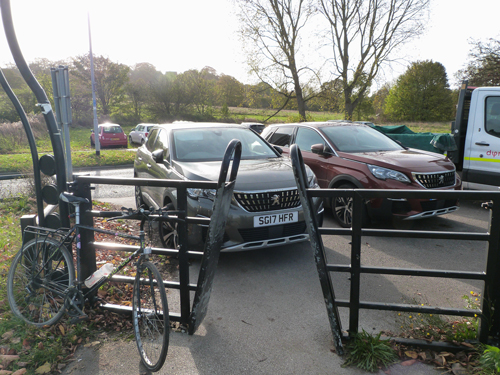
The bike path itself is accessed through an A-frame gate. All the A-frames on this route are set very tight, so you have to shuffle your shoulders and handlebars through with some difficulty.

The route descends to the Wyke Beck and goes through Wyke Beck Woods. This is a nature reserve, and an information board says that herons fish here.
When you emerge from the nature reserve at Asket Hill, you have to cross the busy Easterly Road, but there is another Toucan crossing.
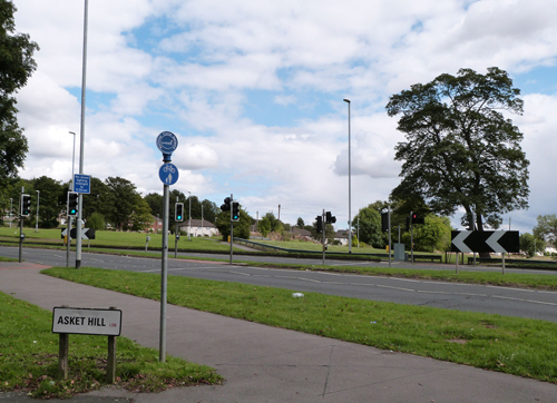
On the other side of Easterly Road, a split walking-cycling path goes through a bit of park called Arthur's Rein.

It leads to Fearnville Fields.

At Fearnville Fields, there's a little metal bridge over Wyke Beck. Turn left immediately after crossing it; there is a small blue sticker on one of the rails of the bridge telling you to go left, but it's easy to miss.

Next you cross a road called South Parkway Approach. On the far side of the road, turn right on a shared use path. White paint indicates Temple Newsam (TM) in one direction and Roundhay Park (RP) in the other.
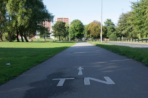
Cross Foundry Lane using the parallel (zebra plus cycle) crossing, and you arrive at Killingbeck Fields.
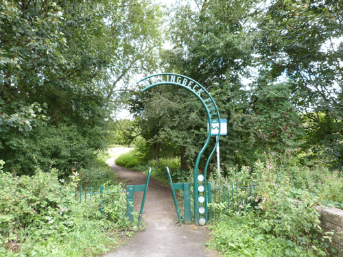
In Killingbeck Fields you have to do a right-left dogleg. The white painted 'TN' and 'RP' markings have completely worn away, so this is one of the points of failure in the signing system.
Some tower blocks are visible in Killingbeck.

Shortly afterwards, there's a 'no cyclists' sign straight ahead, and a little left turn (marked 'TN' on the path).

Follow the path round to the left, and you come to a duck pond.

You then emerge onto Killingbeck Drive, and turn right towards the very busy A64. There's an Asda petrol station on your left, and a Toucan crossing over the A64 to Sutton Approach.
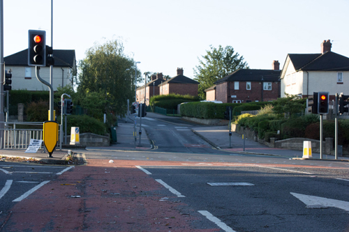
Have a look at the Leeds Bradford Cycle Superhighway, which runs along the A64.
On the other side of the A64, Sutton Approach takes you uphill to a foot and cycle bridge over the railway line, and into Primrose Valley Park.

The route makes its way through Primrose Valley Park.
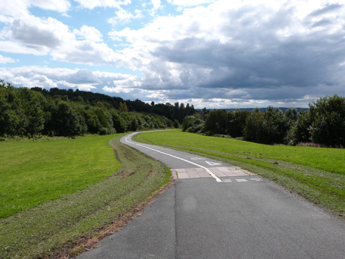
There are good views of Leeds to your right. In a couple of places, according to the white paint on the path, cyclists must give way to special paving.

These markings were in the approximate vicinity of a bench, so the best explanation I can come up with is that this is some sort of pedestrian crossing of the cycle path. I'm pretty sure it doesn't correspond to any interaction that might happen in the real world though. What is it about highways engineers? They seem to lose their minds whenever cycle infrastructure is involved.
There's a junction in Primrose Valley Park, which does have a signpost, but not with any useful places marked on it. Anyway, you have to go straight on, rather than left.
At the exit from Primrose Valley Park, a crossing takes you over the A63 Selby Road.
On the other side of Selby Road, follow Carden Avenue into the Halton Moor housing estate. There are discreet blue cycling signs on lamp posts indicating the route. This doesn't seem to be the nicest area.

Ullswater Crescent and Coronation Parade bring you to the edge of the estate. The signs then abandon you (at the time of writing), but you should turn left on Cartmell Drive.
At the end of Cartmell Drive, continue straight ahead onto Skelton Moor Way, a road through a business park with a big Amazon. There's a shared use path on the right hand side of the road.
When you see Farnell's premises on your right, look out for a (badly-signed) left turn up towards Halton Moor Wood.

There's now a grass, mud, and gravel path, and it takes you past Halton Moor Wood and across Temple Newsam Park Golf Course. Fore!
I enjoyed this bit of the ride, though I have my doubts about the wisdom of starting a route on a good, hard surface, then surprising people with a mountain bike track.
The path joins Temple Newsam Road, which takes you to Temple Newsam house and park.

There doesn't seem to be any cycle parking at Temple Newsam, but there are plenty of railings. An information board has a visitor map.

It shows the café and WC in the Stable Courtyard.

There were lots of house martins perched on the roof and ledges of the house when I visited one September, enjoying the sunshine and perhaps gathering ready to journey south.
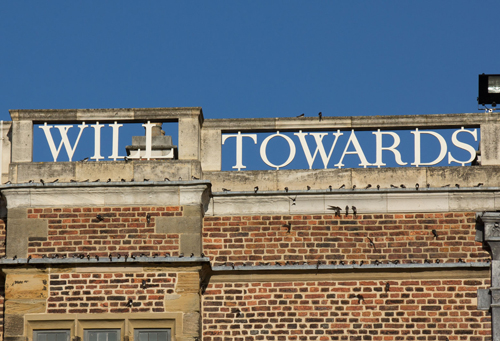
All photos © Hedgehog Cycling
1) Re-paint the TN and RP on the path in Killingbeck Fields. I suggested this in 2018 and nothing has been done in the years since then.
2) Improve the signage at the edge of the Halton Moor estate and towards Halton Moor Wood/Temple Newsam. You can't entice people with the promise of a fully signposted route, then abandon them part way along the route.
3) Cycle parking at Temple Newsam.
4) Remove the A-frame barriers, and replace them with appropriately-spaced bollards as set out in LTN 1/20 guidance.
5) The access to Fearnville Fields from South Parkway Approach has parking immediately in front of it. The arrangement doesn't work because when vehicles are parked there, they block the access.
More generally, if you live in Leeds, this is quite a good way to get to Temple Newsam, and parts of it are nice just as a bike ride. It's probably not a route that many people will travel from outside Leeds for, as there are more enjoyable ones in the countryside.
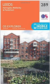
The Wyke Beck Way ride is covered by the 1:25,000 OS Explorer map of Leeds, number 289.
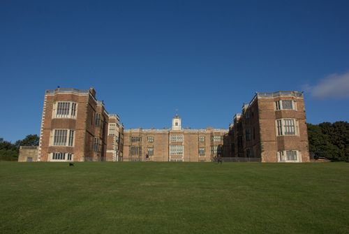
Temple Newsam is a house and country park on the south eastern edge of Leeds.
The Knights Templar owned it from around 1155, and built Temple Newsam Preceptory. That explains why it is called Temple. Between 1500 and 1520, a Tudor country house was built here. Between 1736 and 1746, it was remodelled by Henry Ingram.
In the 1760s, famous landscape gardener Capability Brown landscaped the park.
In 1922, Temple Newsam was sold to Leeds council.
The park is free, and is used by local people for dog-walking, kite-flying, and a Park Run. You can pay to visit the house and home farm. There's also an adventure playground, visitor centre, WC and baby change facilities, football pitches, golf course, and bike trail.
Bike Rides In and Around York features a historical city tour, plus family rides, road rides, and mountain bike rides.
"This book is simply a treasure trove not only of great rides but also as a travel guide to the area."
Read more about Bike Rides In and Around York.

Bike Rides in Harrogate and Nidderdale is a book of family, mountain and road bike rides.
"This guide is a wonderful companion whether you ride alone, with family or friends. Don't set out without it."
Read more about Bike Rides in Harrogate and Nidderdale.

I've seen red kites overhead at Roundhay Park, but you could see them at any point along the way.