
Thirsk LCWIP
North Yorkshire Council (NYC) has published a Local Cycling & Walking Plan (LCWIP) for Thirsk.
Given the council’s track record, it is very unlikely that the paper plans will result in any on-the-ground improvements.
An LCWIP consists of a network plan, a prioritised programme of infrastructure improvements, and a report.
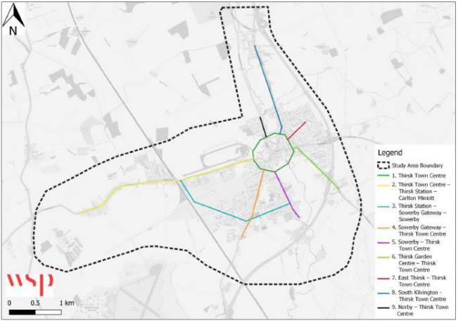
The Thirsk LCWIP covers Thirsk, Sowerby, Carlton Miniott and South Kilvington. Around 10,500 people live in that area. 12% of households in the Hambleton area don’t have a car.
Tourism
The LCWIP notes that tourism accounts for 41,200 jobs in North Yorkshire, or 14% of total employment.
Thirsk had 1.2 million visitors in 2023, and is 9km away from Sutton Bank, in the North York Moors National Park. An Active Travel Study for the National Park is in development.
‘The study is focused on providing a strategic network of active travel corridors that connect key destinations and surrounding gateway towns using both established routes as well as new routes’.
Sowerby Gateway
The Sowerby Gateway residential development is supposed to have provided a contribution of £250,000 for a shared use path to Station Road and Thirsk Station.
Market Town Investment Plan
A Market Town Investment Plan by the former Hambleton District Council suggested these cycling infrastructure improvements:
- a link from Thirsk town centre to the station
- a cycle hub at the station
- upgrade to NCN Route 657 between Sowerby and Thirsk town centre
Existing Travel Patterns
The report notes that:
- 20% of local residents travel less than 2km to work (easy walking distance)
- 27% of residents travel less than 5km to work (easy cycling distance)
At present:
- 65% of residents travel to work by car
- 15% walk
- 3% cycle
Schools
Local schools include South Kilvington Primary, Thirsk Community Primary, All Saints Primary, Keeble Gateway Academy, Sowerby Community Primary, Thirsk School and Sixth Form College, and Carlton Miniott Primary.
There should be provision for active travel to these schools.
Cycle Network Map
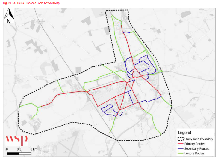
One of the outputs of the LCWIP is a cycle network map.
LCWIP Priorities
Table 5.3 has the LCWIP’s active travel priority routes, with indicative costings. They are:
- Thirsk town centre
- Widened footways between town centre and Carlton Miniott
- Path from Sowerby to Thirsk station
- Shared use path from town centre to Sowerby Gateway
- Minor improvements to town centre to Sowerby route to encourage walking and on-road cycling
- Town centre to Blakey Lane (A170 south east of Thirsk)
- Thirsk to East Thirsk, segregated cycleway on Long Street and shared path on Sutton Road
- Thirsk to South Kilvington, pedestrian improvements
- Thirsk to Norby, shared path on Northallerton Road