
Oxford Greeways Plan
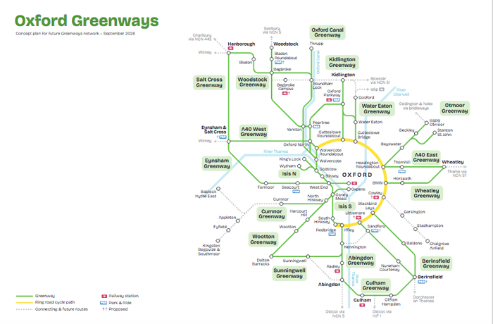
Oxford has published a plan for 18 greenways connecting surrounding towns and villages to the ring road cycle path and the city centre. The radius covered is 5 to 8 miles.
It has been developed by Oxfordshire County Council, Oxford City Council and the University of Oxford. It is based on Oxford’s Strategic Active Travel Network, and is an important element of the delivery of Oxfordshire’s Local Transport and Connectivity Plan.
Improvements are needed for some routes; others are new.
The type of provision varies: some routes are traffic-free, while others are paths next to busy roads or quiet road routes.
A London Underground-style map shows the plan clearly. A report by Red Kite Management Consulting outlines the work that has been done on the 18 routes.
After a consultation in February and March 2025, the plan is agreed.
The next steps are more design work, and finding funding. Three priority routes have been identified – Isis South, Kidlington and Otmoor.