
Ambitious Leeds City Links Cycle Infrastructure Plans

Leeds City Council is consulting on some brilliant and exciting active travel schemes near the city centre, under the title Leeds City Links. The consultation is open until 19th November 2023.
Where are the Proposed Changes?

The map above shows Leeds City Links in light blue, and how they fit in with existing and developing cycle infrastructure.
There are two corridors:
- a northern corridor, along Great George Street and Merrion Street and
- a southern corridor along Kirkgate, High Court, The Calls, Call Lane and Swinegate
Problems, Solutions and Trade-Offs
The problems on both the northern and southern corridor are largely the same. They include:
- narrow pavements
- complex crossing arrangements that make trips on foot longer and less convenient
- wide roads and big junctions that encourage speed
- lack of space for street cafés
- lack of safe cycling provision
- street clutter
- limited greenery
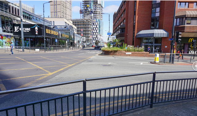
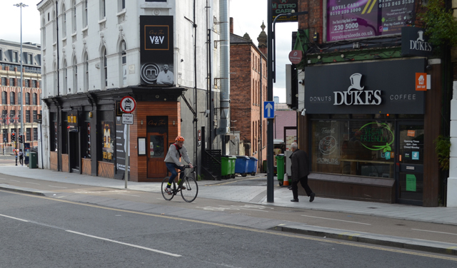
This image shows part of Great George Street as it is now, with some of the problems described above.

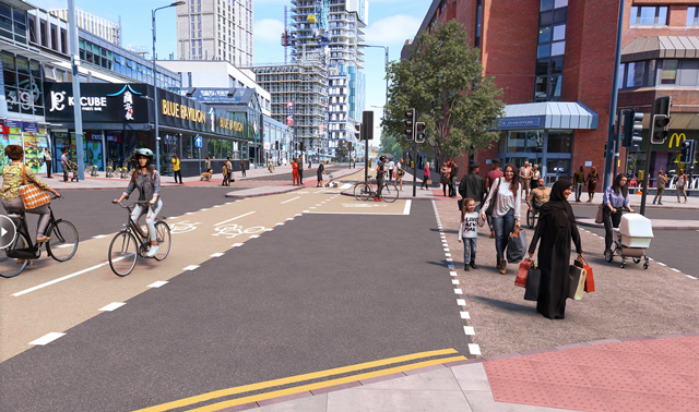
And this is a visual of how it would look.

This simplified plan shows the proposed changes in a different way.

The benefits of the changes include:
- safer for people walking, wheeling and cycling
- easier to cross the road
- wider pavements with opportunities for street cafés
- new greenery
- most car routes not affected
The consultation identifies trade-off such as:
- some loss of pay & display parking
- minor changes to some car routes (but most not affected)
This is the ‘before’ picture of Merrion Street.
And this is ‘after’.
One of the pedestrian improvements is the removal of the guard rails.
A trade-off of the design is reduction in the number of general traffic lanes. The consultation says ‘but analysis shows this can accommodate current traffic levels’.
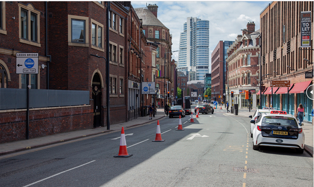
There are some great visuals for the southern corridor too. This image shows Kirkgate ‘before’.

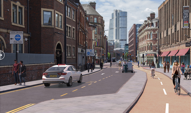
And this is Kirkgate ‘after’.

The Call Lane/Swinegate images show a particularly exciting improvement. This is ‘before’.
And this is ‘after’.
Pedestrian Improvements
As well as the removal of guard rails, there will be wider pavements and new crossings, which include:
- light-controlled crossings that make it shorter, easier and safer to cross and
- continuous crossings
Continuous crossings give pedestrians and cyclists effective priority over side streets, as shown below.
Background
Leeds City Links is intended to apply Leeds City Council’s Transport Strategy. Among the goals are:
- for Leeds to be a city where you don’t need a car
- to increase walking by 33% by 2030 and
- to increase cycling by 400% by 2030
It also supports Leeds’ Vision Zero 2040 Strategy, which aims to have zero road deaths by 2040. There have been 62 casualties on these routes between 2013 and 2022.
The closure of City Square has reduced through traffic in the city centre, and road space can now be allocated to walking, wheeling and cycling.