
ATE Scheme Sketcher

Active Travel England (ATE) has released a Scheme Sketcher Tool.
It’s a vector graphics programme that local authorities (or anyone) can use to draw points and lines, and highlight areas, on a map provided by Open Street Map. You can add notes associated with the points, lines and areas, which describe proposed schemes.
In the sketch above, I have used it to recreate the Beech Grove route into Harrogate, with modal filters on Lancaster Road and Beech Grove.
Sketches are auto-saved in your browser’s local storage, but of course if you clear your browser they are lost.
It’s possible to download the sketches as .geojson files, and send them to colleagues by email.
Video Tutorial
There’s a video tutorial by ATE’s Kit Allwinter which shows how to use the tool.
Sketcher
The Sketcher can be used to sketch schemes such as School Streets, modal filters, area treatments or cycle tracks.
Browser
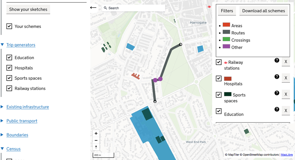
There is also a Browser element to the tool.
You can look at the scheme you’ve sketched and add other layers to the map. Other layer options include trip generators like stations, hospitals, sports spaces and schools.
You can also add 2021 Census data such as the percentage of households with a car.
