Cycling in Yorkshire & Beyond

Cycling in Yorkshire & Beyond
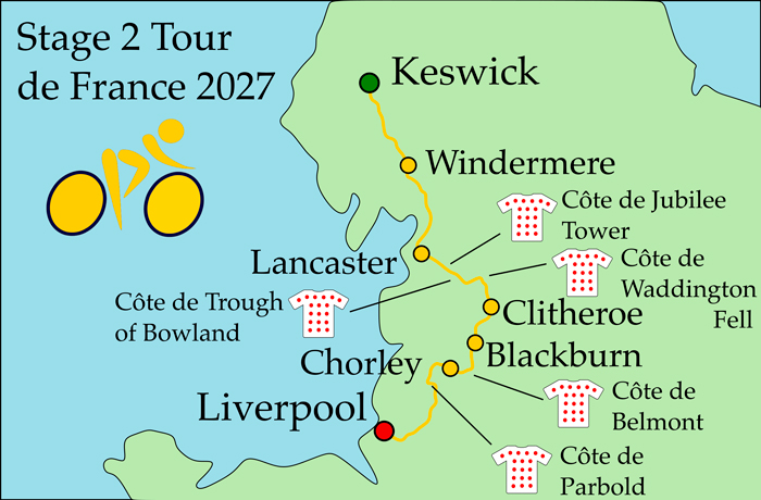
Stage 2 of the Tour de France 2027 is a 223km hilly stage from Keswick to Liverpool.
The opening kilometres are in the Lake District National Park, passing along the shore of Lake Windemere. The route then heads further south through Carnforth, Morecambe and Lancaster.
Next the Forest of Bowland provides three categorised climbs, including the Côte de Trough of Bowland.
Then Stage 2 goes through Clitheroe and Blackburn, working its way into the built-up areas of Lancashire and the Liverpool City Region.
There are a couple more categorised climbs in the final third of the stage - the Côte de Belmont and the Côte de Parbold. Neither of them is very challenging.
There's a descent around 1km before the finish, as the race heads down Parliament Street towards the waterfront.
The finish line is by the Royal Liver building, near Liverpool Docks.
Race Details | Poll | Map & Profile | Timings | Videos | Food & Drink | Route Notes | Favourites
| Date | Saturday 3rd July 2027 |
|---|---|
| Stage classification | Hilly |
| Distance | 223km |
| Intermediate sprint | TBC |
| Climbs | Côte de Jubilee Tower Côte de Trough of Bowland Côte de Waddington Fell Côte de Belmont Côte de Parbold |
| Total climbing | TBC |
Vote for one of the main contenders to win Stage 2 (to be added later).
This is a map of the route of Stage 2, Tour de France 2027.
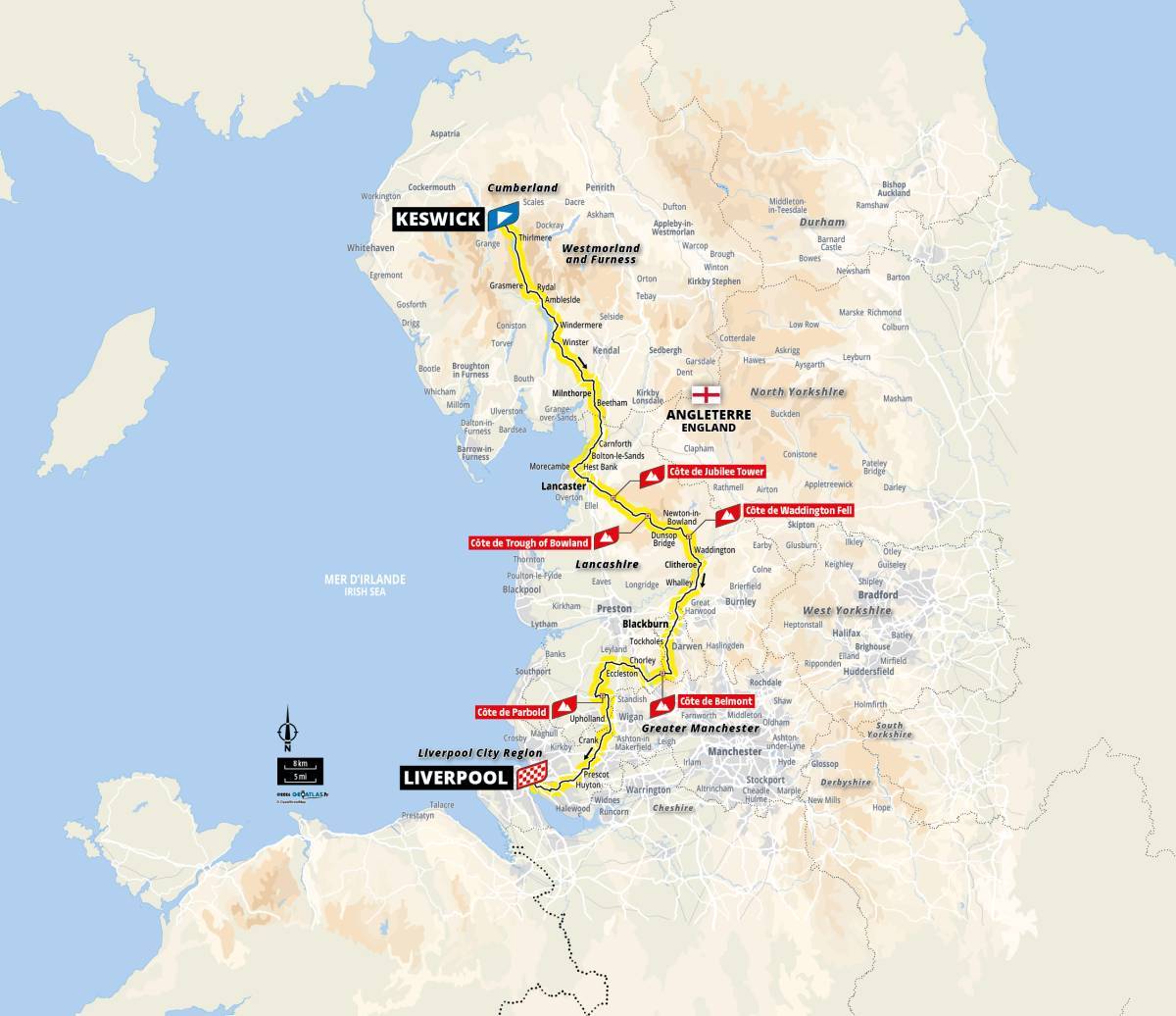
This is a zoom-able map of Stage 2 Tour de France 2027. I have plotted it based on the map image above, and on the route videos on the official Le Tour GB site. I am confident that it is largely accurate, but it is not possible to get all the details 100% right.
(I'm sure that it is a lot closer to the actual route than other plotted maps I've seen online).
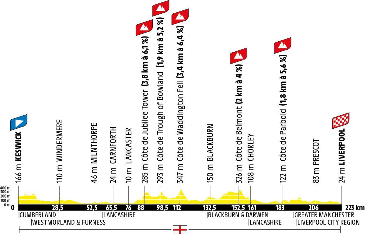
This is the profile of Stage 2 Tour de France 2027.
| Caravan | Fast Schedule | Slow Schedule | |
|---|---|---|---|
| Start Time (départ fictif) | |||
| Start Time (départ réel) | |||
| Intermediate Sprint | |||
| Climb | |||
| Finish Line (223km) |

Get the official Tour de France 2026 Race Guide.
The fully authorised guide includes detailed stage maps, team profiles, expert analysis and stunning photography.
Available in Standard and Premium Editions.

Get a bundle with the premium race guide, Cycling Plus Ride Like a Pro, plus socks, coasters and an allen key, for £26.38.

This is a video of the route of Stage 2 Tour de France 2027.
This is my video of highlights of the route of Stage 2 Tour de France 2027.

Stage 2 is a race down the west coast of England, from Keswick to Liverpool. It goes through Lancaster.
Lancashire hotpot is a local speciality. It is lamb and onion topped with sliced potatoes and baked slowly on a low heat.
Potted shrimps are a favourite at nearby Morecambe.
The race grazes the edge of Greater Manchester. Manchester Caviar is actually mushy peas, often eaten with fish and chips.
Eccles cakes are flaky pastry cases filled with currants and topped with sugar. James Birch first sold them from his pastry shop in 1793.
Vimto, originally called Vimtonic, was invented in Manchester in 1908.
There are lots of breweries in Manchester, so the stage is probably best accompanied by beer.
Buy a case of eight Manchester beers (affiliate link).
Liverpool is known for scouse, a meat and vegetable stew that is based on a recipe brought here by Norwegian sailors.
The stage starts in Keswick (départ fictif).
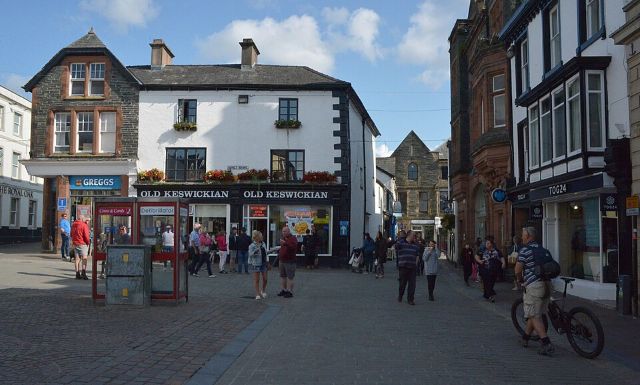
Stage 2 starts in the Lake District town of Keswick. The neutralised section is likely to begin at the Moot Hall in Market Square.
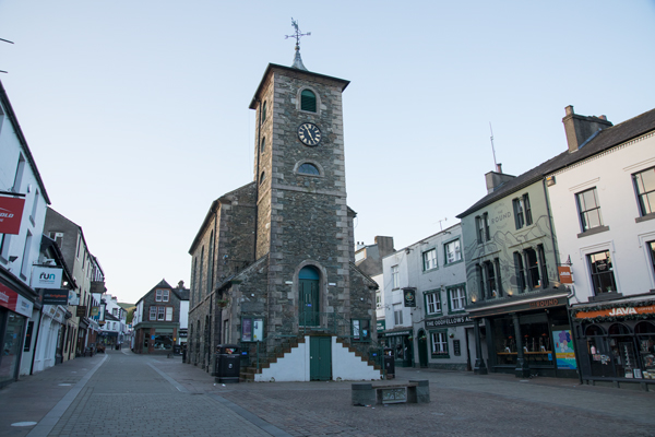
Keswick is a market town and holiday destination at the north end of Derwent Water. Its population is around 5,000.
Keswick's name might be a mixture of Old English and Viking, and mean 'farm where cheese is made'.
Keswick was granted a charter to hold a market by Edward 1 in 1276, and sheep and wool were traded there. The market has been held without interruption from 1276 to the present day.
In the 1500s, copper was mined around Keswick with the expertise of copper miners from Germany. Graphite was mined too, and from the second half of the 1700s it was used to make pencils.
From the 1700s, the Lake Poets' descriptions of the area (Thomas Gray, Samuel Taylor Coleridge, Robert Southey and William Wordsworth) attracted tourists to visit.
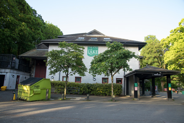
Keswick's biggest attractions are the nearby fells, such as Skiddaw, Grisedale Pike and Helvellyn; and Derwent Water for boat trips and water sports.
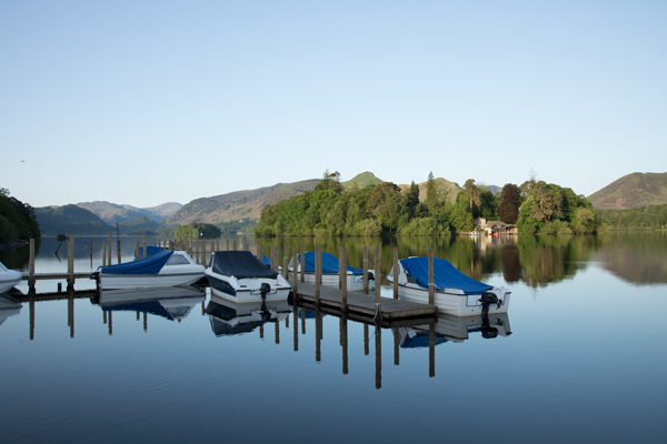
Visitor attractions include the Theatre by the Lake, the Pencil Museum, the Puzzling Place, and the climbing wall.
The départ réel will be on the outskirts of Keswick.
The riders set off on the A5271 Penrith Road then (climbing Chestnut Hill) the A591 Castlerigg Brow.
The A591 runs along Thirlmere from north to south.
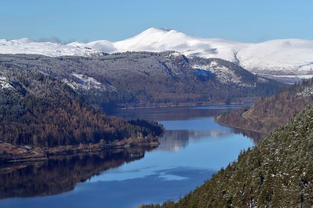
It will be fine for the Tour de France when the road is closed, but is described by one contributor to a Cycling UK forum as 'largely a horrific road' for cycling.
Next Stage 2 passes Grasmere (the village and the lake).
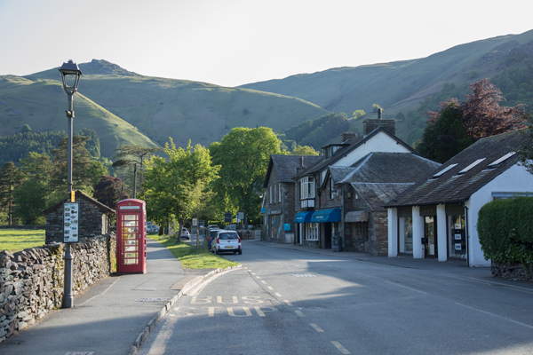
Grasmere is a village and lake in the Lake District.
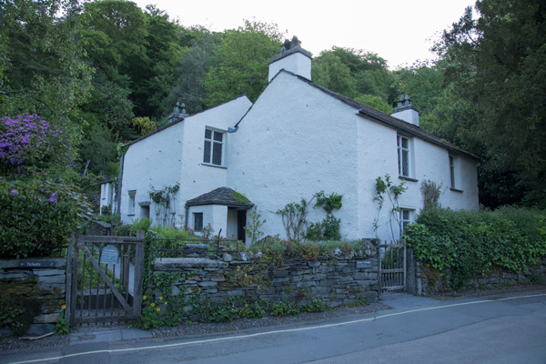
It is famous as the home of William Wordsworth and his sister Dorothy; they lived in Dove Cottage.
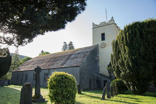
Wordsworth and his wife are buried in the graveyard of St Oswald's Church.
Grasmere is known for its gingerbread.
Immediately south of Grasmere village is Grasmere lake.
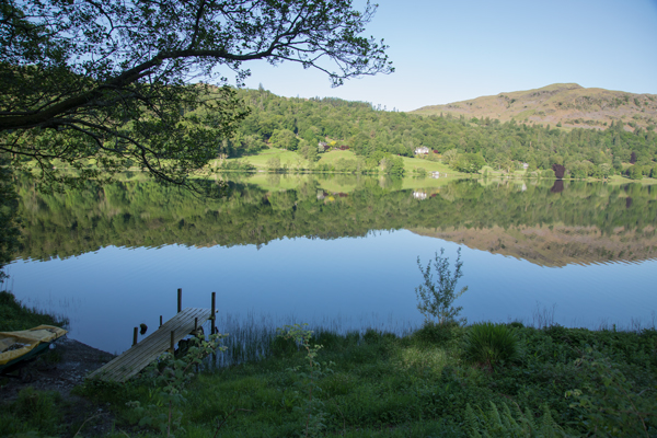
Next after Grasmere, the race passes Rydal Water and the hamlet of Rydal.
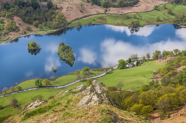
Rydal is a village in the Lake District by Rydal Water.
The village is a cluster of houses, a hotel and St Mary's Church.
William Wordsworth lived at Rydal Mount from 1813 to 1850.
The route continues to Ambleside.
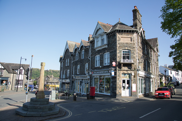
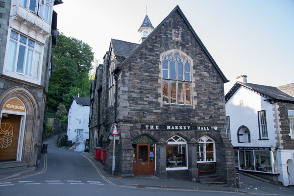
Ambleside is a village in the Lake District at the head of England's largest natural lake, Windermere. The population is about 2,500.
The Roman fort of Galava (founded 79AD, rebuilt under Hadrian in the early 100s) was sited here and housed 500 Roman auxiliaries. It was linked to a fort on the coast at Ravenglass by a road via Wrynose and Hardknott passes.
A civilian town (vicus) grew up by Galava.
Ambleside got a charter to hold a market in 1650, and wool and other goods were bought and sold at Market Place.
One of Ambleside's famous landmarks is Bridge House.
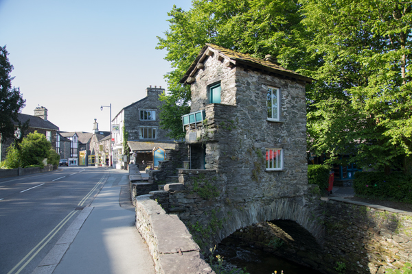
It was built in the 1600s or 1700s as a summer house and apple store. Since then, it has been a counting house for local mills, a tea room, weaving shop, cobblers, chair-makers and even a family home. Now it belongs to the National Trust.
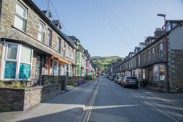
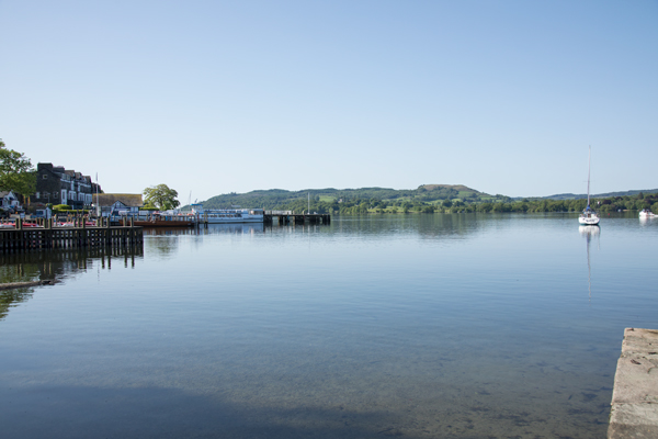
Ambleside is a base for walking in the fells. There are also 'steamers' - ferries from Ambleside's Waterhead area to Bowness-on-Windermere, and other places around Lake Windermere.
There are two Michelin-starred restaurants in Ambleside.
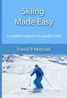
Skiing Made Easy is a practical guide to learning to ski based on many happy seasons of ski teaching.
It takes you through the beginner's progression from snowplough to parallel turns, starting at the very beginning and not assuming any prior knowledge.
The book suggests relevant exercises to develop and improve your skills. Common faults are identified, along with the best ways to correct them.
'By the way' sections contain information about many of the little things that people assume you just know, but you may not.
'This is the book I wish I'd had when I started skiing' - reviewer on Amazon.
How to buy:

Skiing Made Easier is the follow-up to Skiing Made Easy, and picks up from where the first book left off.
The first chapter is Refining Your Parallel Turns.
The chapters on ski technique beyond basic parallel turns are Carving, Short Turns, Bumps and Off Piste.
There are then further chapters on Avalanche and Mountain Safety, Ski Psychology, Physical Preparation, Ski Servicing and Alpine Wildlife.
As in Skiing Made Easy, common faults are identified and exercises suggested to correct them and to develop your skills.
'By the way' passages contain bits of skiing knowhow that could otherwise take years to pick up.
How to buy:
The Amazon URLs are affiliate links.
Now the race continues on the A591 Lake Road, past the National Trust's Stagshaw Garden (azaleas and rhododendrons), along the shore of Lake Windermere past Brocknhole National Park Visitor Centre, and via Troutbeck Bridge to the town of Windermere.
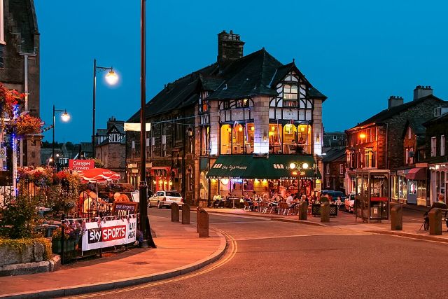
Windermere was called Birthwaite before the railway came. It grew after the arrival of the railway in 1847, and the Windermere Hotel opened.
Next Stage 2 takes the A5074 the short distance to Bowness-on-Windermere.
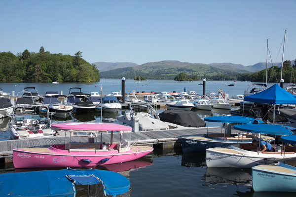
Bowness-on-Windermere is a town on the shore of Lake Windermere with a population of about 4,000.
It's name is said to be an evolution from 'Bulnes', meaning the headland where the bull grazes.
There are records of churches here in the 1400s, and a grammar school was founded in 1600.
Bowness grew during the 1800s from a small fishing village to a holiday town. As well as tourism, boat-building was an industry here.
The railway reached Windermere in 1847, the residents of Bowness having opposed a station in their own town.
There's a cable ferry that can carry cars from Bowness to Far Sawrey on the western side of the lake.
In fiction, Bowness is the model for Rio in Arthur Ransome's Swallows and Amazons.
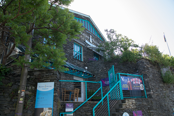
Bowness is home to an attraction called The World of Beatrix Potter.
Just north of Bowness is the Windermere Jetty Museum, focused on steamboats.
After passing Windermere Marina, the riders take the B5284 Longtail Hill, then the A5074 Kendal Road up Barker Knott hill.
The road is always up and down with lots of bends: it is a 'grippy' British road. It passes through Winster, then meets the A590 near Foulshaw Moss Nature Reserve, where ospreys nest.
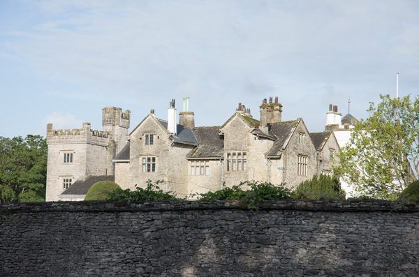
Here, the race goes left on the A590, then right on the A6 Princes Way, over the river Kent on Levens Bridge and past Levens Hall.
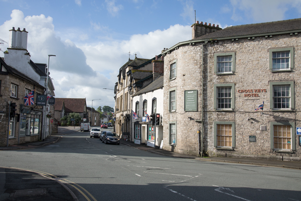
Still on the A6, Stage 2 continues to Heversham and Milnthorpe.
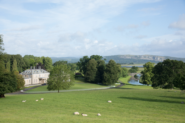
Just off the main road at Milnthorpe is Dallam Tower country house and deer park.
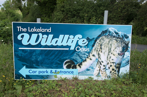
The A6 continues to Beetham, then past the Lakeland Wildlife Oasis.
A series of three roundabouts take the riders past Pine Lake, then they head on to Carnforth.
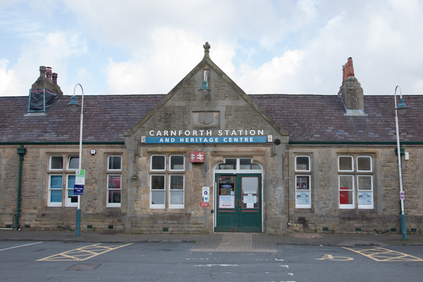
Carnforth is a market town that falls within the City of Lancaster, Lancashire. Its name comes from Keerford, a ford of the river Keer.
In the 1800s, it expanded due to the railway and its ironworks (established 1846). Local limestone, used in the smelting process, meant that Carnforth was a good location for the ironworks.
Later, Carnforth was a railway depot, at the junction of three railway lines.
The railway station was the location used to film the David Lean movie Brief Encounter in 1945, written by Noel Coward and starring Celia Johnson and Trevor Howard.
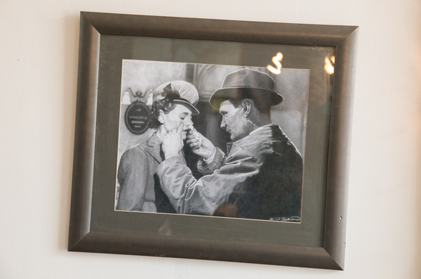
In the film Carnforth Station was Milford Junction.
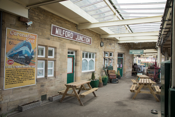
There is now a Brief Encounter Refreshment Room, made to look like the film set and with lots of memorabilia.
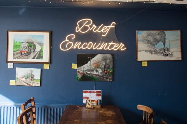
There's a Heritage Centre too.
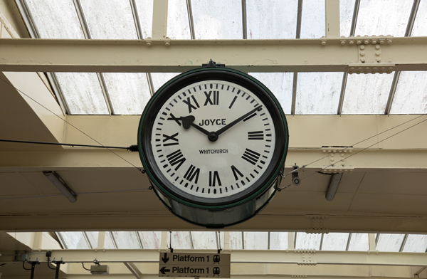
The clock that featured in the film was painstakingly restored over a number of years. When it was unveiled, the little curtain they used to reveal it got stuck on one of the hands and broke the mechanism!
This is the film itself.
Stage 2 continues through Bolton-le-Sands and Hest Bank to Morecambe.
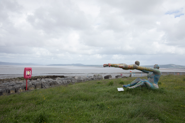
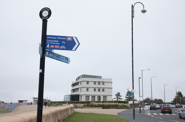
The fourth inlet north of Wales has been called Morecambe Bay since Roman times, but the town itself is an amalgamation of three hamlets that came about in 1889.
Morecambe's railway history began in 1848, and the railway was key to a hundred golden years as a holiday resort for the masses.
In recent decades, Morecambe has undeniably been in decline.
It's future could be as a nice, calm seaside resort with attractions including the restored Midland Hotel and the planned Eden Project North.

The race turns left on the A589 Broadway, rather than going to Morecambe proper.
It then takes the B5321 Torrisholme Road before coming back to the A589 to cross the river Lune on Skerton Bridge. The riders are now in Lancaster.
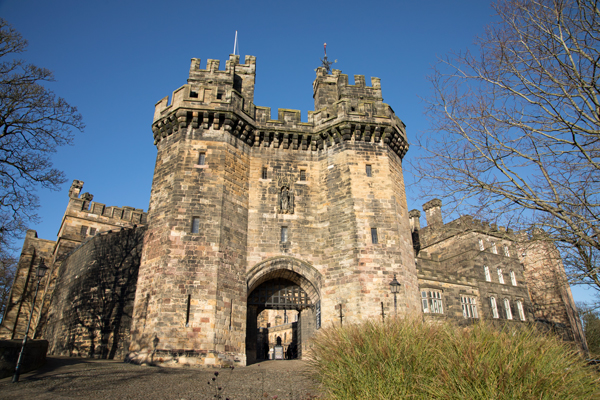
Lancaster is a city on the river Lune and the Lancaster Canal. It has a population of around 52,000 in the city itself.
It started out as a Roman fort, and the castle on that site has remained important over the centuries.
The Port of Lancaster thrived from trade in spices and slaves.
In Lancaster the race takes the A6 North Road, then turns left on Nelson Street. Lancaster Town Hall is at the corner of North Road and Nelson Street.
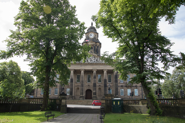
Nelson Street crosses the Lancaster Canal then becomes East Road.
Stage 2 forks right on Wyresdale Road, which goes past Lancaster Royal Grammar School and Williamson Park. It is a steep-ish hill.
The Ashton Memorial is in Williamson Park.
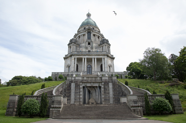
Wyresdale Road/Langthwaite Road takes the race under the M6, then over the river Conder to Quernmore.
From Quernmore, the riders tackle the first categorised climb of the stage, the Côte de Jubilee Tower.
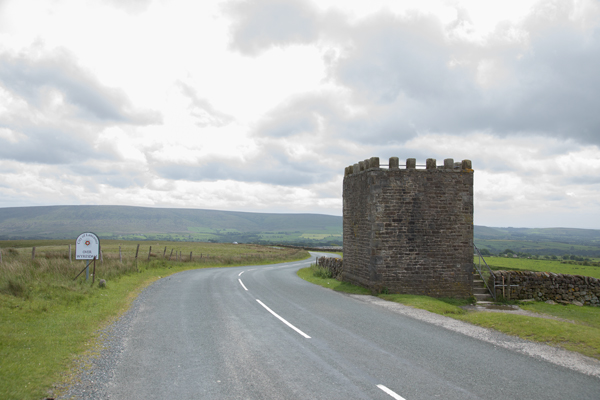
The Côte de Jubilee Tower is steep at first, but more undulating further up. It is 3.8km at 6.1%.
This video shows the climb of the Côte de Jubilee Tower.
The road descends to cross the river Grizedale and the Tarnbrook Wyre at Lee.
At a hamlet called Marshaw, the race joins Trough Road. After following the Marshaw Wyre river, it ascends to the Trough of Bowland.
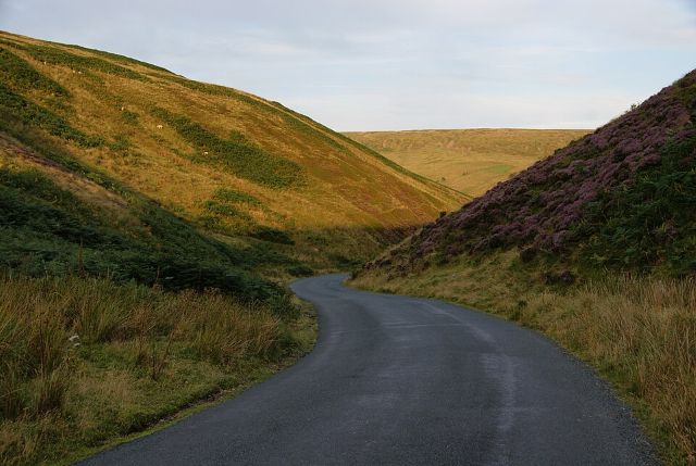
The Trough of Bowland is a U-shaped high valley in the Forest of Bowland.
The Côte de Trough of Bowland is 1.9km at an average 5.2%. This video shows the climb.
There's a descent by Langden Brook to Dunsop Bridge.
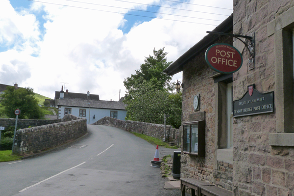
Dunsop Bridge is a village at the confluence of the rivers Dunsop and Hodder.
It developed in the mid-1800s because of lead-mining in the area.
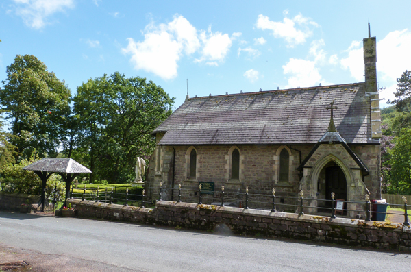
The little Roman Catholic church is dedicated to St Hubert, and was designed by Edward Pugin. It opened in 1865.
From Dunsop Bridge, the riders head east along the river Hodder to Newton-in-Bowland.
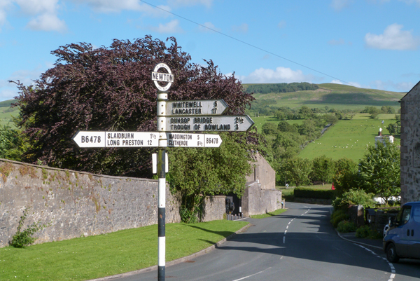
Newton-in-Bowland is a village on the river Hodder.
The Parkers Arms in Newton takes its name from the Parker family, Lords of Bowland for many generations. It is known for its upmarket food.
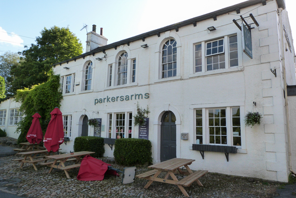
In Newton, the peloton turns right, going south on the B6478 Hallgate Hill towards Waddington Fell.
This is the next categorised climb, the Côte de Waddington Fell.
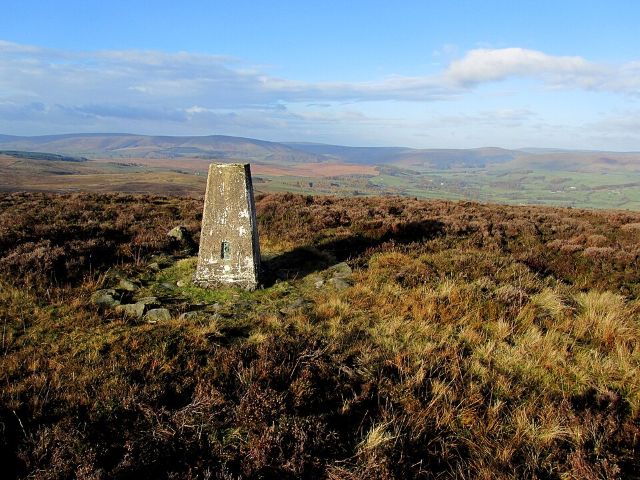
The Côte de Waddington Fell consists of several steep ramps, with flatter sections in between. Overall, it is 3.4km at an average 6.4%.
This video shows the climb.
The height at the cattle grid at the top of the climb is 352m.
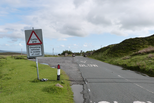
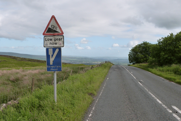
The descent is on what is now called Slaidburn Road. Signs warn that it's steep (13%), and there's an escape lane.
The race passes through the village of Waddington.
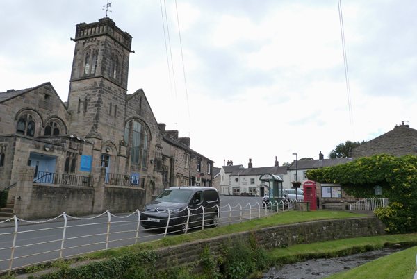
Waddington is a village with a population of just over 1,000.
It has three pubs, and often wins the Best Kept Village in Lancashire award.
The B6478 continues to Clitheroe.
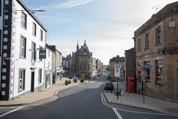
Clitheroe is a town in the Ribble valley, with a population of around 16,279 people. It's near the Forest of Bowland and at the foot of Pendle Hill.
Clitheroe has a Norman castle keep, one of the smallest in England.
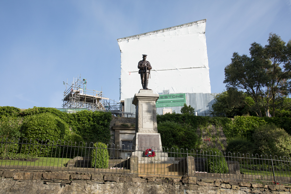
In Norman times, the local lord was Roger de Poitevin. Subsequent lords were the de Lacy family, who may have built the castle.
In 1310 it passed to Thomas, Earl of Lancaster. The Duke of Albermarle was given it by Charles II in 1660 after the Restoration of the Monarchy.
A steward's house was built in 1723, which now houses Clitheroe Castle Museum.
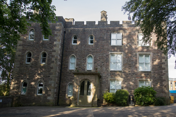
The museum promises to take you through 350 million years of local history (going through the first 349 million quite quickly, I hope).
'Very interesting small museum. Plenty of information about Clitheroe itself and some nice touches with audio stories about legends,' says Lancs22 on Tripdavisor.
In the gardens around the castle is a turret from the Houses of Parliament, known as the Pinnacle.
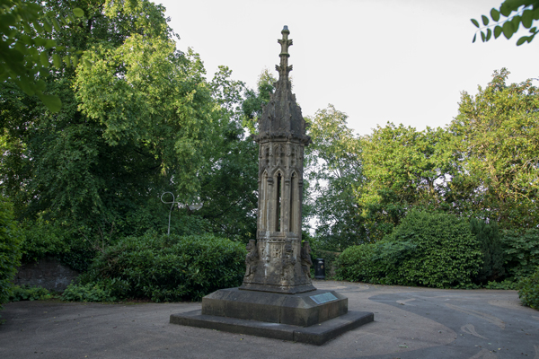
Jet engines for aircraft were developed and tested by Frank Whittle in Clitheroe during World War II, together with engineers from Rover and Rolls Royce. They met at the Swan & Royal Hotel.
The quarry and cement company Heidelberg is one of the biggest local employers.
Dugdlae Nutrition produces animal feed here.
Alfie the Odd-Job Boy of Clitheroe is a BBC Three documentary following Alfie, who uses a tandem bike and trailer to run his business doing practical jobs around town.
The race leaves Clitheroe on Whalley Road, heading through Barrow to Whalley.
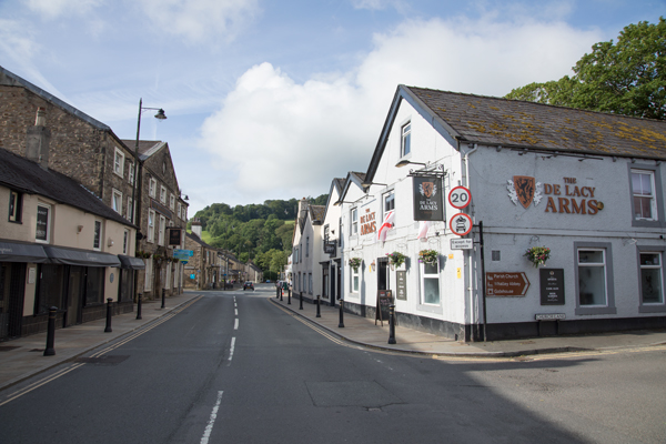
Whalley is a village in Lancashire, on the banks of the river Calder (a tributary of the Ribble).
The village was flooded in 2015 and 2020.
Portfield Hillfort, a late Bronze Age or Iron Age fort, overlooks Whalley.
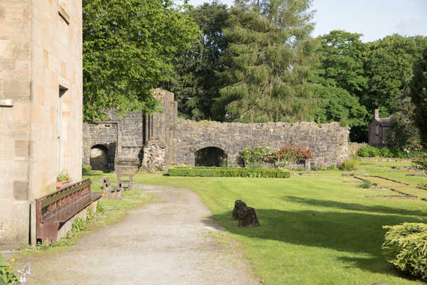
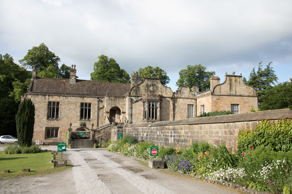
Whalley Abbey was a Cistercian monastery founded in 1296. The abbey buildings were put up gradually in the 1300s and 1400s.
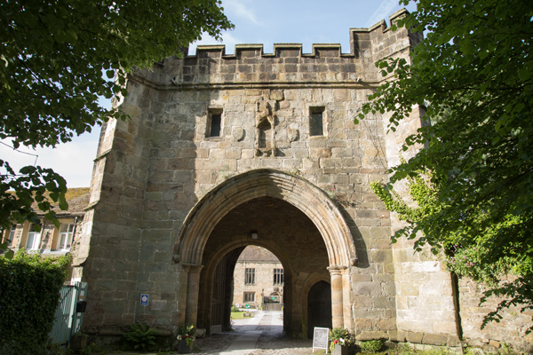
The abbey closed in 1537 during Henry VIII's Dissolution of the Monasteries. The abbey buildings and land were sold, and the new owner built a large house on the site.
The house is now used as a centre of religious education, and as a retreat and conference venue.
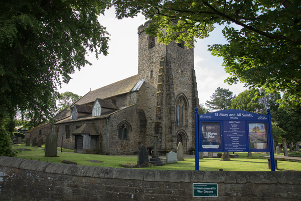
Whalley church was founded in 628 when Paulinus preached here. There are Anglo-Saxon crosses in the churchyard.
The church has misericords from the 1400s which used to belong to the abbey.
Leaving Whalley, Stage 2 crosses the river Calder. As the road climbs away from the river, there's a view of Whalley Viaduct, or Whalley Arches.
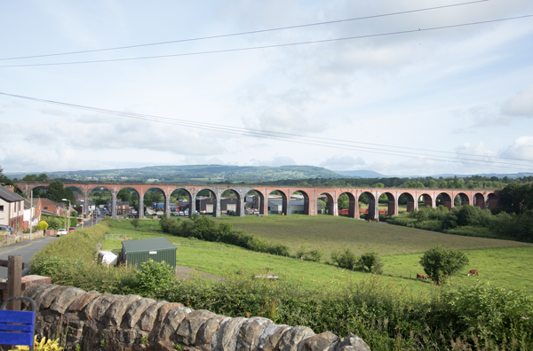
Whalley Viaduct was finished in 1850; it's the longest and largest railway viaduct in Lancashire.
Still on Whalley Road Stage 2 goes through Billington, then joins the A666 which takes the riders via Langho and Wilpshire to Blackburn.
The A666 takes the race into Blackburn.
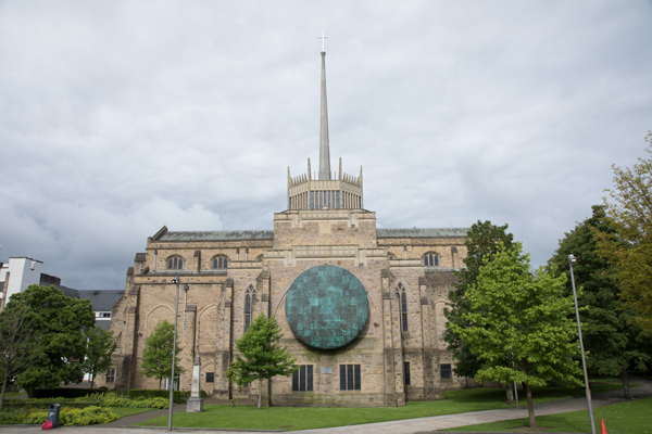
Blackburn (population 118,000) is the second-largest town in Lancashire after Blackpool.
A Roman road between Ribchester and Manchester crossed the river Blakewater here. A Roman temple to Serapis has been discovered at what is now All Hallows Spring.
In Anglo-Saxon times, the Blackburnshire Hundred was part of Northumbria.
Woollen cloth was woven here from the 1200s, and by the 1600s the town was known for the manufacture of blue and white 'Blackburn checks'.
Textile manufacturing (cotton) boomed during the Industrial Revolution, and Blackburn became 'the weaving capital of the world'.
Post-World War II cotton mills began closing, and by the late 1970s most of them were gone.
There have been attempts at economic renewal in recent times.
Blackburn Cathedral was a parish church until given its current status in 1926.
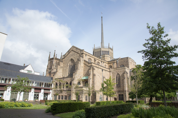
The modern extension to the older building was constructed from the 1930s to the 1960s.
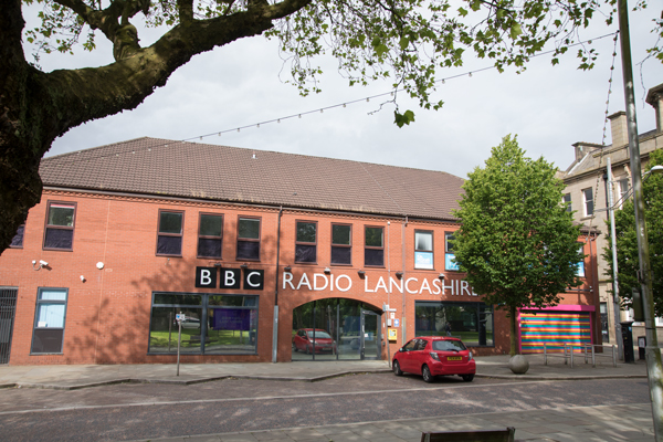
BBC Radio Lancashire has its studios in Darwen Street, in the town centre.
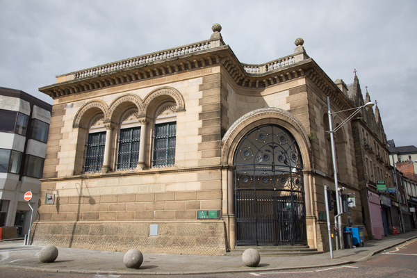
There are some grand buildings left over from Blackburn's more prosperous days, such as the Old Bank.
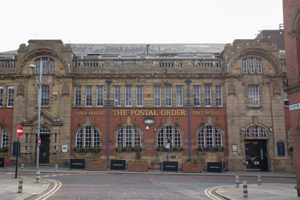
Another grand pile is the Postal Order, built in 1907 as the main Post Office and now a Wetherspoons.
Blackburn has plenty of more down-to-earth buildings too.

Barbara Castle was the local MP from 1945-1979. Alfred Wainwright (1907-1991) was a native of the town.
The actor Ian McShane (Lovejoy) was born in Blackburn in 1942, and Steve Pemberton (b. 1967) is from Blackburn too.
In Blackburn, the race goes past the Cathedral, crosses the river Blakewater, then joins the A666 Bolton Road and goes over the Leeds & Liverpool Canal. A little further on, it goes under the railway and over the river Darwen.
Now it passes Ewood Park, home of Blackburn Rovers who won the Premier League in 1995.
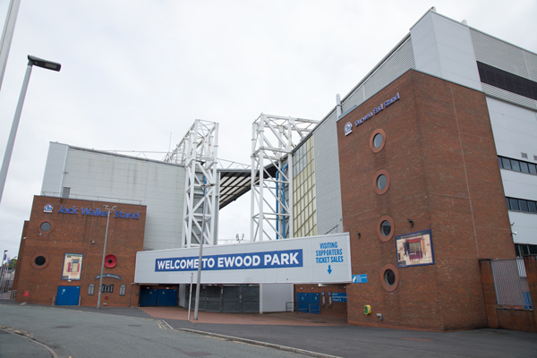
Steel magnate Jack Walker invested in Blackburn Rovers and was responsible for their success in the 1990s.
The riders leave Blackburn/Ewood going south on Heys Lane/Tockholes Road, up to Bog Heights, then down to Ryal Fold near Upper Raddlesworth Reservoir.
Stage 2 then joins the A675 Belmont Road which goes along the side of Belmont Reservoir.
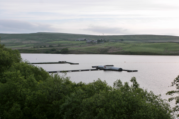
It continues through the village of Belmont, then race turns right on Rivington Road past the Black Dog.
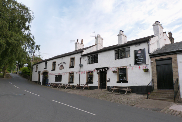
Rivington Road climbs - the Côte de Belmont.
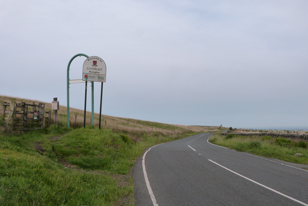
The Côte de Belmont is 2km at an average 4% gradient, reaching a height of 326m at Hordern Stoops.
This video shows the climb of the Côte de Belmont.
The descent on Sheep House Lane takes the peloton down to Rivington and over Rivington Reservoir.
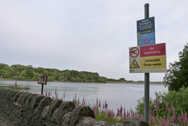
At the other side of the reservoir, the race turns right on New Road and crosses the M61.
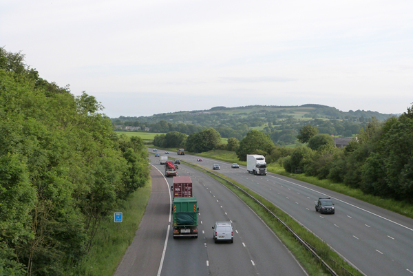
The riders turn right on Long Lane, shadowing the M61 to Limbrick. Then they go through Cowling and arrive on the edge of Chorley.
The race turns right on the A6 to pass Chorley Bus Station.
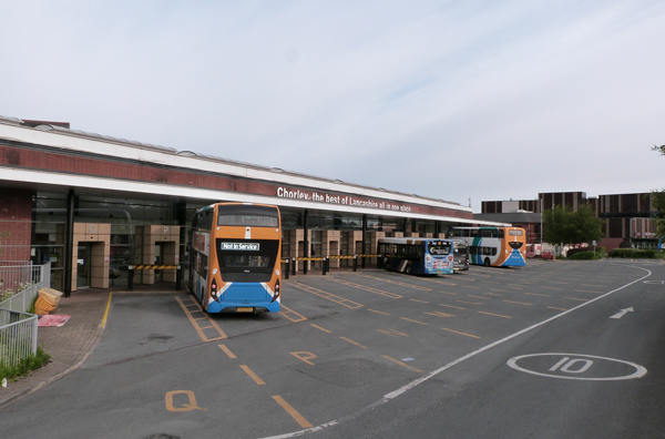
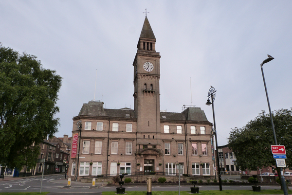
Chorley is a town of 37,000 people about 20 miles.
It doesn't appear in the historical records until the mid-1200s. St Laurence's church was dedicated in 1362 and a royal charter for a market was granted in 1498.
Chorley expanded during the Industrial Revolution, with cotton mills and coal-mining.
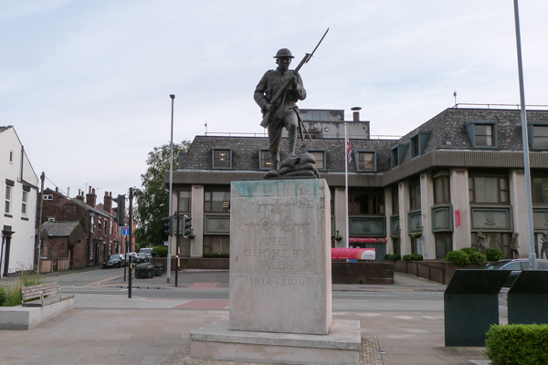
The town has a monument to the Chorley Pals (a company in the East Lancashire Regiment) who died in World War I.
There was a munitions factory in Euxton during World War II. Tanks and other military vehicles were built here too.
Most industry closed down post-War, but Leyland Trucks and BAE Systems are still big local employers.
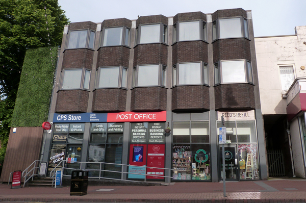
The Chorley cake is a flattened pastry filled with dried fruit.
From Chorley, the riders are on the A581 Dawber's Lane to Euxton, and they continue over the M6 motorway and through the hamlet of Shaw Green.
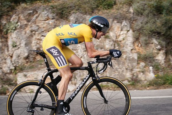
Then they turn left on the B5250 Lydiate Lane, across the river Yarrow to Eccleston. Bradley Wiggins lived in Eccleston at the peak of his cycling career.
This part of the race is on relatively narrow lanes. Stage 2 passes Andertons Mill and Hill Dale before reaching Parbold.
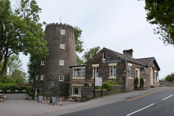
Parbold is a village with a population of 2,600.
After the Norman Conquest it was part of the Barony of Manchester, and grants of land in this area were made to Burscough Priory.
From the 1700s, coal and sandstone were quarried here.
Parbold Windmill was built next to the Leeds & Liverpool Canal around 1794 to grind flour. It now houses the Mill House Gallery.
As it leaves Parbold, the race joins the A5209, crosses the Leeds & Liverpool Canal and the railway, then begins next climb, the Côte de Parbold.
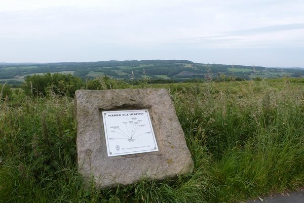
This climb is from Parbold on the A5209 Sparrow Hill. Just off the A-road is the Parbold Bottle, a monument celebrating the passing of the Great Reform Act 1832.
The Côte de Parbold is 1.8km at an average 5.6%.
This video shows the climb of the Côte de Parbold.
Next the riders turn right on the B5375 Appley Lane North. At Appley Bridge they go over the railway, the Leeds & Liverpool Canal and the river Douglas.
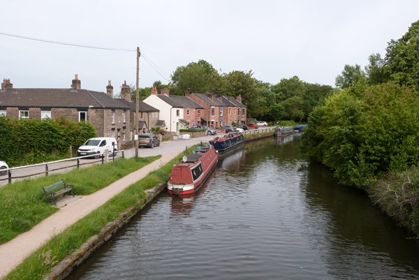
The race continues on Appley Lane South to Bank Top and Roby Mill.
It then goes through Upholland and Higher End. Johnny Vegas attended a seminary in Upholland.
The riders then take Crank Road to Crank, which has the Crank Caverns.
Stage 2 then crosses the A580 at Windle and takes the B5201 Bleak Hill Road through the second Eccleston of the day.
The B5201 passes close to Knowsley Safari Park.
Now the race goes through Prescot on the A57, and Huyton-with-Roby on the B5199.
The A5080 Roby Road takes the riders over the M62, and they are now approaching the finish in Liverpool.
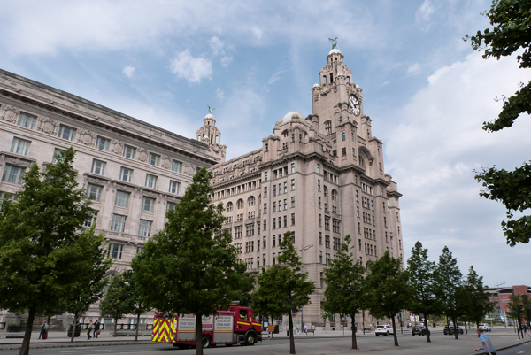
The Stage 2 finish is in Liverpool.
From the A5080 Roby Road/Bowring Park Road, Stage 2 forks right on Rocky Lane.
There's a left turn onto the A5058 Queens Drive, followed by a right turn at a junction called Allerton Maze onto the A562 Smithdown Road/Allerton Road.
The race passes Penny Lane on the left.
The riders turn left on Greenbank Drive towards Sefton Park. The park has an elegant palm house.
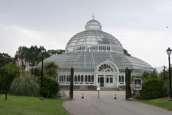
In the park, the riders turn right on Mossley Hill Drive, then they leave the park on the B5175 Croxteth Road/Princes Avenue/Princes Road.
The parcours is then left on the A562 Parliament Street, which is downhill towards the waterfront.
The riders then go right on the A5040 Chaloner Street/Wapping/Strand Street, past the docks of the Mersey estuary.
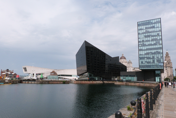
They finish in front of the Royal Liver Building.
This video shows the last 5km of the stage.
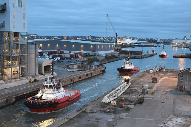
Liverpool is a port city with a population of 509,000.
It was established in 1207, but became important from the late 1600s through its port.
Cotton was imported to Liverpool and transported on to the Lancashire cotton mills. Liverpool was also involved with the Atlantic slave trade.
Many English and Irish emigrants left Liverpool for America.
Liverpool became a city in 1880.
The Beatles were the city's most famous musicians in the 1960s.
It was European Capital of Culture in 2008.
The city has two big football clubs, Liverpool and Everton.

Stage 2 is hilly, but the last climb is 40km before the finish. It could be a day for a breakaway or it could be a bunch sprint.
Who do you think will win Stage 2 of the 2027 Tour de France?

Price £84.99 from Amazon at the time of writing (affiliate link).
As an Amazon Associate, I earn from qualifying purchases.

Bike Rides in the Yorkshire Dales is available in colour paperback.
Find out more about Bike Rides in the Yorkshire Dales or buy a copy.

Bike Rides In and Around York features a historical city tour, plus family rides, road rides, and mountain bike rides.
Find out more about Bike Rides In and Around York or buy a copy.

Bike Rides in Harrogate and Nidderdale is a book of family, mountain and road bike rides.
Find out more about Bike Rides in Harrogate and Nidderdale or buy a copy.

Find out more about Mountain Bike Rides in the Yorkshire Dales.
Buy Mountain Bike Rides in the Yorkshire Dales at £8 + P&P.

Garmin Edge Explore, £197.99 at the time of writing.
Garmin Edge Explore on Amazon (affiliate link).

Faster by Michael Hutchinson on Amazon (affiliate link).


